
Follow an East Brunswick Street Directory Trail
Street research begins with the address, not a name. Write down the number and unit, street spelling, postal city, ZIP code, legal municipality, block, lot, qualifier, and parcel PIN when those values are available. East Brunswick records may use different forms of the same place: the assessment hub uses a property field, county GIS uses a property location field, a deed uses its legal description, and an older directory may use a rural-route or nearby post-office label. Keeping the original form beside the modern form makes later comparisons much safer.
The practical order is to identify the parcel first, then test the names and historical household evidence attached to it. The municipal assessor, county assessment hub, GIS layer, County Clerk index, voter-status tool, and regional directories do not create one combined roster. Each supplies a limited part of an address trail. A recorded owner is not necessarily an occupant, and a directory listing is an evidence point for its publication year rather than proof of continuous residence.
- Search the Middlesex County Property Assessment Search Hub by property address, then set Town to East Brunswick when a result needs narrowing.
- Use the county parcel layer to confirm the polygon, block, lot, property location, mailing fields, and deed-book reference.
- Search the Middlesex County Clerk land-record index with the town and legal property identifiers to identify recorded instruments and party roles.
- Use the state voter tool only to check an individual’s registration after an exact-name and county match. It is not a public street roster.
- For a past household, compare regional directory years and any available reverse or criss-cross volume with the parcel evidence.
Note: Keep a separate date for every result, because a monthly parcel view, a recorded deed, and a printed directory describe different moments.
East Brunswick Address Search Fields
The county assessment hub is the best first stop for a modern address lead. Its visible controls include Town Filter, Owner Name, Property, B.L.Q. Filter, Class Filter, Class4 Filter, Sales Date Filter, Sales Price Range Filter, Building Square Feet Range Filter, and Year Built Range Filter. Use the Property field for an address and Owner Name only when a person is already connected to the research question. The interface accepts * for any number of characters and ? for one character, which helps when street suffixes or names vary.
| Assessment hub field | Use for a street search | Format or limit |
|---|---|---|
| Town Filter | Limit results to East Brunswick | Apply before a broad property search. |
| Property | Find an address or street lead | Compare the returned property string with the parcel field. |
| Owner Name | Test a recorded-owner lead | Use surname variants and initials; it does not prove occupancy. |
| B.L.Q. Filter | Target the legal parcel key | Block, lot, and qualifier can resolve similar street names. |
| Sales and building filters | Narrow a large result set | Useful filters, not a resident-list field. |
A capture of the assessment hub shows the property and owner filters that make an East Brunswick by-address search more precise. 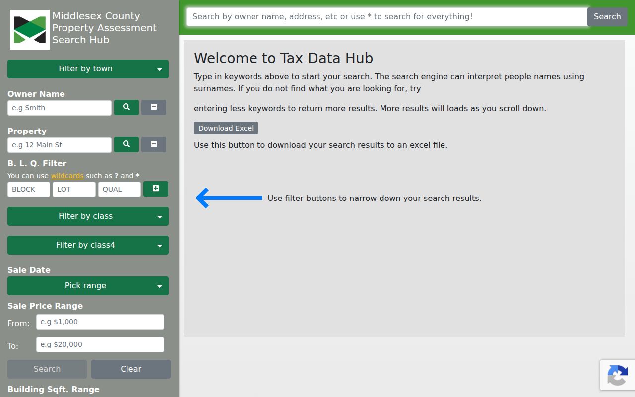 Use the result as a lead, then retain the block and lot before moving to GIS or deed records.
The East Brunswick Tax Assessor keeps tax maps, ownership records, sales, descriptions, and property information. Its office is at 1 Jean Walling Civic Center Drive and can help when the online hub returns no result, when a property card needs explanation, when a tax map is needed, or when a historic description predates the portal. The assessor values real estate for assessment purposes. That work is useful for a parcel trail but is not a statement about who occupies a home.
Map East Brunswick Streets by Parcel
Middlesex County GIS is the geography check in an East Brunswick address search. The public parcel service supports query, identify, export, geometry, statistics, order-by, pagination, distance, and find operations. Its fields include PAMS PIN, municipality, block, lot, property location, land description, OwnerAddr1 and OwnerAddr2, ZipCode, sales date, deed book and page, value, year built, and geometry. It updates monthly as municipalities update MOD-IV, so its value is a current parcel snapshot rather than a historic map of occupancy.
A streetwide search should be narrowed by municipality and street or situs text, block, or parcel geometry before it is expanded. The service has a maximum record count of 2,000, so pagination matters on a broad query. Displaying nearby polygons can show parcels across the road or behind a lot. The polygons are helpful map evidence, but they are not a survey and do not replace the legal description in a recorded instrument.
- Parcel
- A mapped unit of land identified by local tax and legal identifiers.
- Situs address
- The site or property location, which can differ from the owner’s mailing address.
- Legal description
- The block, lot, map, or written land description that identifies property more reliably than a changing street string.
- Criss-cross directory
- A reverse directory arranged by street or address rather than alphabetically by surname.
County GIS notes that a display alias for an owner name exists, but the visible field list does not expose a general owner-name field. Statewide parcel and tax-list material also has Daniel’s Law redactions. A map can therefore show the parcel, value, mailing ZIP, or deed references without displaying a current owner name. Treat an empty name field as a privacy or data-design limitation, not proof that no record exists.
Separate East Brunswick Street Address Types
One property can carry several address values. GIS PropLoc identifies the parcel location. OwnerAddr1 and OwnerAddr2, along with ZipCode, are mailing fields. The deed’s legal description, block, and lot control the land identity. A voter record uses a registration address, while USPS uses a delivery address and postal city. The county assessment hub’s Property field may be a situs string. Those values are related, but they should never be silently substituted for one another.
East Brunswick’s legal municipality and a postal label can also diverge. The primary East Brunswick postal code is 08816, while nearby postal labels include Helmetta, Monroe Township, Milltown, Old Bridge, Spotswood, and North Brunswick candidates. Verify a full address first with the USPS address tools and then with the New Jersey municipality lookup, which accepts street address, city, state, and an optional ZIP. Finish with the county parcel layer. A ZIP by itself cannot identify every parcel or resident.
Note: Transcribe the postal city found in a historic record before mapping it to the legal municipality, especially on township edges.
Use Middlesex Deeds Along a Street
The Clerk’s land-record index takes the address trail from a mapped parcel to recorded documents. Party Name is entered last-first and can also accept company names. The interface offers Document Type, Town, Date Range in MM/DD/YYYY format, consideration filtering, Property mode, Instrument Number, Book/Page, Lot/Block, Legal Description, Map Number, Parcel ID, District, and additional map, submap, parcel, and week modes. Set Town to East Brunswick and prefer block, lot, legal description, map, parcel ID, or a deed reference when a street name has changed or is common.
For each result, record the instrument number, recorded date and time, type, book and page, consideration, legal lines, town, parties and roles, notes, and linked documents. Follow a prior deed or reference document rather than assuming a mortgage, lien, easement, release, power of attorney, or trade-name filing is a transfer. A grantor conveys or gives an interest; a grantee receives it. Either party may be an executor, trustee, attorney, or other nonresident participant.
The County Clerk’s public search displays the address-oriented and legal-property controls used for a street-by-street deed inquiry. 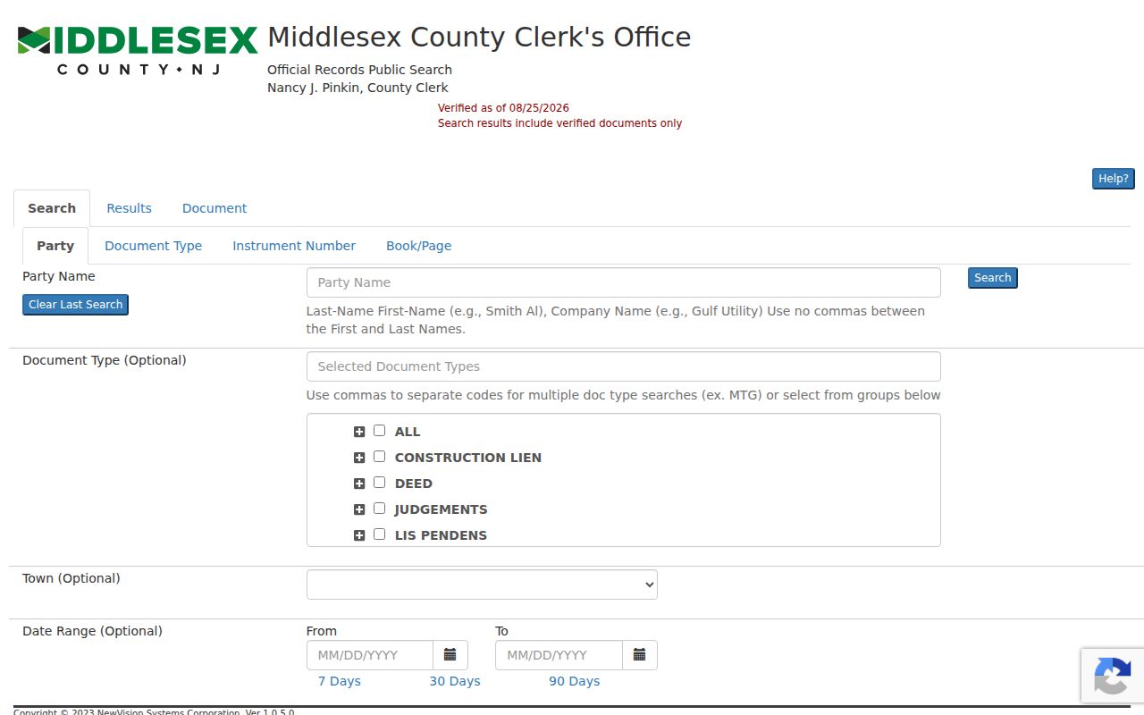 The index connects the parcel key to recorded instruments; review the document type and party role before describing the result as an ownership lead.
East Brunswick Deed Date Gaps
Online coverage has a clear boundary. Middlesex reports deeds from 1929 forward, mortgages from 1950 forward, and other documents from 1958 forward in the online system. A county digitization announcement says public deeds were extended from the 1950s back to 1923, with the project continuing. The locality guide adds archival deed series from 1784 to 1901 and indexes from 1784 to 1922. The County Clerk also says land records on file reach back to 1683. A pre-1929 street trail can therefore require the public record room, a written copy request, county archival material, or a State Library and locality-guide lead.
A County Clerk records-search capture illustrates why browser access should be treated as only one layer of a by-street search. 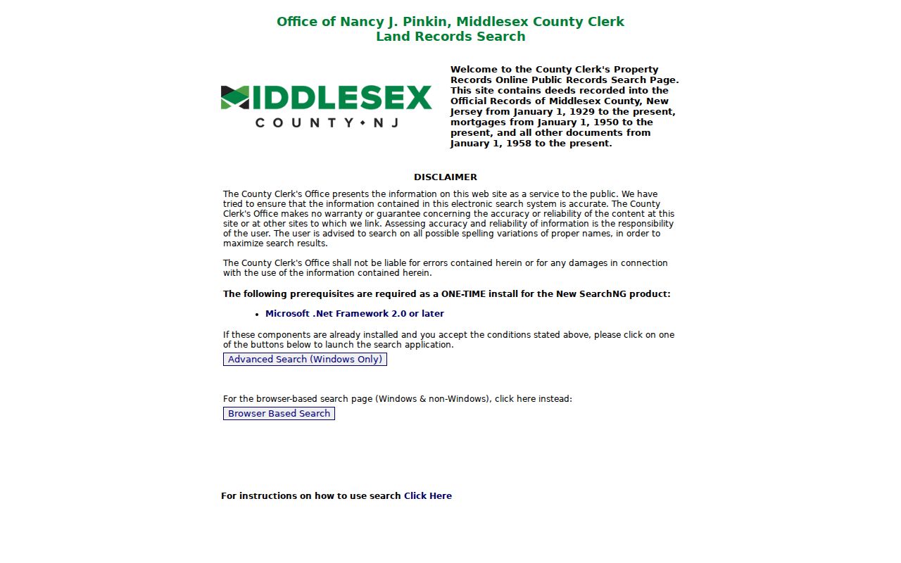 For in-person research, the Registry of Deeds public record room is on the fourth floor of the County Administration Building, 75 Bayard Street, New Brunswick. Hours are Monday through Friday, 8:30 a.m. to 4:10 p.m.; staff can explain computerized indexing but do not perform title searches.
This Profile 1 numbers finding is useful: the online start year, archival index years, and earlier county holdings are not the same series. Record the series and date range used for each conclusion. That discipline stops a web-index gap from becoming a false claim that a street or household did not exist.
Historic East Brunswick Street Labels
East Brunswick incorporated in 1860. Helmetta, South River, Spotswood, and Milltown withdrew during 1870 through 1908, and Old Bridge remains part of the township’s historic story while also being a neighboring municipal and postal label. An older deed, directory, map, or newspaper can use one of those place names even when a modern address checker returns something else. Preserve the original wording, then compare the deed’s legal description and the municipality lookup before deciding whether it identifies the same parcel.
Riva Avenue, Farrington Lake, the Old Bridge and South River areas, rural routes, rail connections, and pottery or brickmaking references can be search terms in older records. They are location context, not a basis to infer a person’s identity or background. New Brunswick regional directories appear in runs from 1855 through 1981, but a complete standalone East Brunswick run was not verified. When an old address matters, the East Brunswick city directory page provides the collection trail without turning a regional listing into a guaranteed local match.
East Brunswick Address Record Sources
Address-keyed sources work best as a chain. The assessor and assessment hub supply a current property lead. GIS supplies the parcel geometry and fields that bridge to the legal identifiers. The Clerk index supplies recorded instruments, while historic directories give snapshots of how a household or address was listed in a publication year. Voter status is an individual check after an exact-name match, not a way to build a streetwide list. Code Enforcement and permit routes may be address clues when public, but the research did not locate a complete East Brunswick public permit or person index.
| East Brunswick address source | Key | What it contributes | Main limit |
|---|---|---|---|
| Tax Assessor | Street, map, owner | Tax maps, ownership records, sales, descriptions | Not proof of occupancy. |
| Assessment Hub | Property, owner, B.L.Q. | Current parcel filters and export | Portal history and card fields vary. |
| County GIS | Situs, parcel, block, lot | Geometry, mailing ZIP, deed references | Current map snapshot; owner visibility can vary. |
| County Clerk index | Town, party, legal line, map, block, lot | Recorded conveyance and related instruments | Index is not occupancy proof; images may be gated. |
| Regional directories | Surname or reverse street entry | Historical listing at an address | Regional coverage, not a verified standalone local run. |
The free county property-fraud alert can monitor a party name or a municipality, block, and lot legal description. It is a monitoring tool, not a guarantee against fraudulent recording. For a questionable deed-copy letter or alert, verify the notice through the official Clerk information instead of using the contact details printed on an unexpected mailing.
East Brunswick Voter Status Limits
New Jersey’s Am I Registered? tool is an individual status check. The state says the supplied name must match the county record exactly, so spacing, hyphenation, maiden or former names, middle initials, and nicknames can produce an inconclusive result. The dynamic portal did not expose a stable full field list in the research capture, so it is not safe to promise a displayed address or date-of-birth field. Contact the county office if an exact-name search needs clarification.
A voter may request a computer-generated or electronic registered-voter list for one or more election districts from the county commissioner of registration, with reproduction cost capped at $375. That statutory request route is different from the public status tool. Signatures are excluded, and approved covered-person addresses can be redacted. The County Clerk Elections office and Board of Elections are both at Kennedy Boulevard in East Brunswick, but their responsibilities differ: the Clerk handles clerk-managed election records, while the Board handles registration, ballots, counting, and election administration.
East Brunswick Address Privacy Limits
An address record does not make every household detail public. A parcel map may show a location while owner-name visibility is restricted. Voter-list access excludes signatures and can redact protected home addresses. Daniel’s Law permits covered people to seek redaction or nondisclosure of home addresses and unpublished phone numbers on government websites. The New Jersey Address Confidentiality Program gives eligible participants a legal substitute address for future exposure, although it cannot erase an address already public in a record. A missing field must not be treated as proof that someone has no connection to a place.
New Jersey’s anti-stalking and harassment laws, N.J.S.A. 2C:12-10 and N.J.S.A. 2C:33-4, set an important boundary for research by street. Use records for family history, personal property questions, civic transparency, or fraud awareness. Do not use address records to watch, threaten, intimidate, or repeatedly contact another person. The official records also do not support a bulk dump of protected identifiers or a claim about who presently lives in every home.
Lawful use. East Brunswick street records are useful for personal, lawful research and property history; using them to stalk, harass, or harm anyone is prohibited.